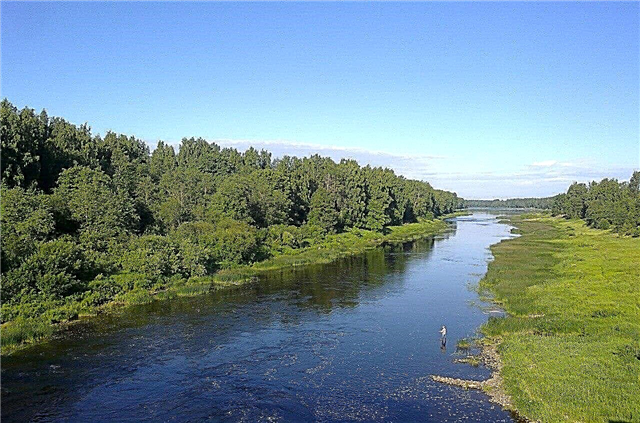
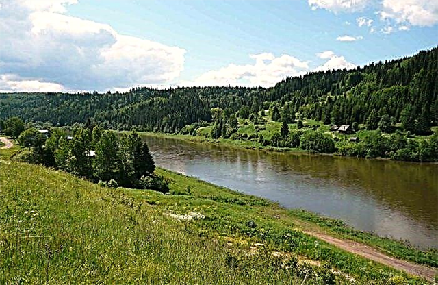
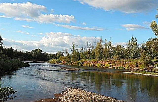
The Perm Territory has an extensive water system. The rest of the reservoirs are either located in its basin, or are connected by a system of tributaries. It stands out among others for its length; the next river on the list, Chusovaya, is three times shorter. There are many fishing spots in the region. This is one of the directions of domestic tourism. The second, not inferior in popularity, is alloys.
Mountain and rapids rivers with a fast flow, like Vizhay, attract extreme lovers. The shores are moderately populated, as mainly villages and villages are located on them. The absence of people and their vigorous activity in the district has a beneficial effect on the environment. Mulyanka and other waterways that flow in Perm were a little less fortunate in this regard.
List of the longest rivers of the Perm region
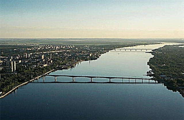
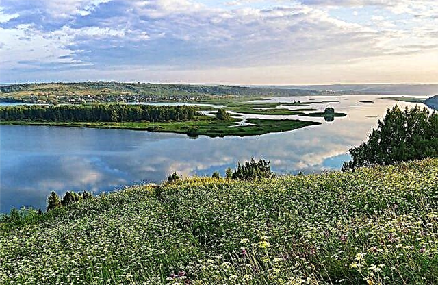
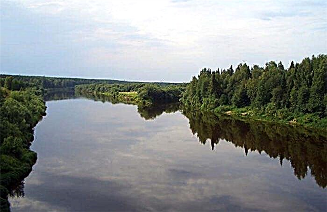
Kama
In addition to the Perm Territory, it flows through the territory of 4 more regions. One of the largest tributaries of the Volga. Before the appearance of the Kuibyshev reservoir, Kama was even longer. The total number of tributaries exceeds 74 thousand. About half of the channel is navigable. Kama has been known since ancient times; oxbows are visible in some parts of the floodplain. An annual sailing competition is held.
The length of the river is 1805 km, in the Perm Territory - 910 km.
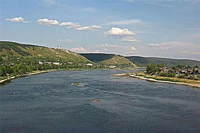
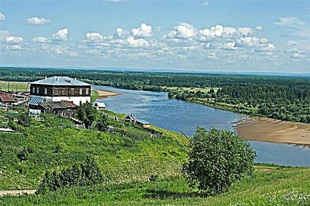
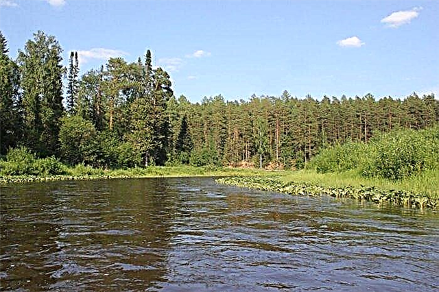
Chusovaya
Also applies to the Chelyabinsk and Sverdlovsk regions. Left tributary of the Kama. Extensive forests are found only in the middle reaches. The rest of the zones are covered with meadows, swamps, woodlands. There are fishing grounds, colonies of crayfish and flocks of waterfowl. The river basin is rich in minerals including gold and diamonds. Vessels can ply along the channel, but there are restrictions.
The length of the river is 592 km, in the Perm Territory - 195 km.
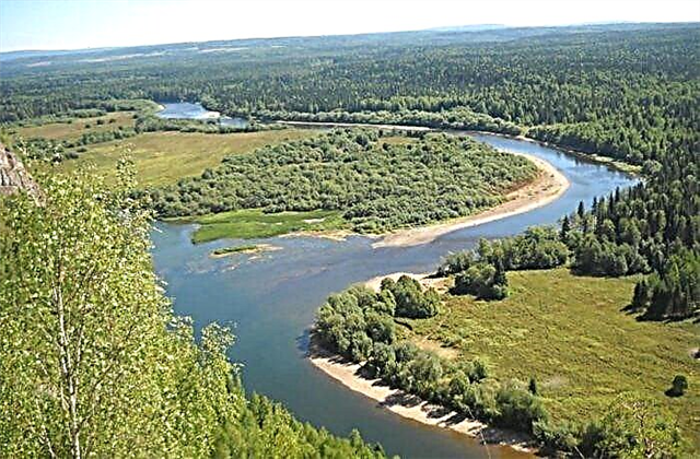
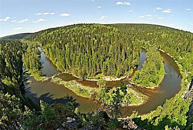
Sylva
Source in the Middle Urals, flows into the Kama reservoir. It is distinguished by a calm current, which is even more moderate in the lower reaches. The Transsib passes along the section of the left bank. Sight - Molebsk anomalous zone, popular among ufologists. Excavations were carried out in the Sylva basin. Found an archaeological site Elnika II, which is about 250 thousand years old.
The length of the river is 493 km.
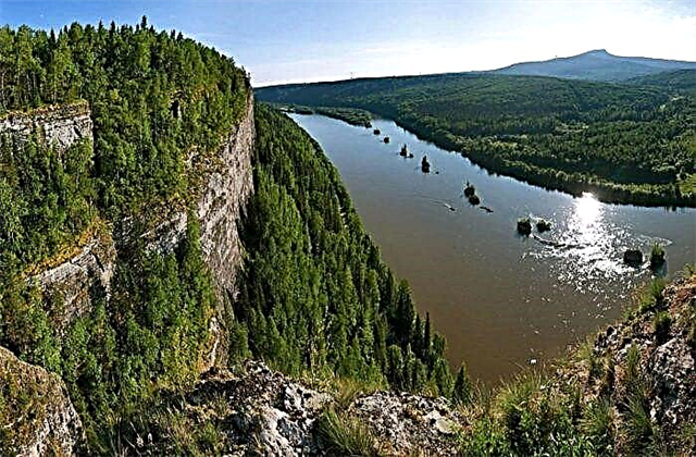
Colva
It flows in the Cherdyn region. The banks are steep, they are typically covered with forests or meadows. The water is characterized by high transparency and purity. Colva is variable in width. For example, it narrows as much as possible near the confluence with the Vishera. Rocks and shallows make it difficult for ecotourism enthusiasts to travel along the riverbed. The natural attractions of the pool are the Fighter Rock and the Divya Cave.
The length of the river is 460 km.
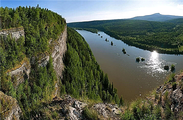
Vishera
The left tributary of the Kama, flowing into the Kama reservoir. The banks contrast with each other. On the one hand, there is a lowland, on the other, there are fragmentarily overgrown rocks several meters high. Deposits of diamonds have been explored. Regular passenger service during the summer months. The upper reaches are part of the Vishera reserve. For this reason, fishing in this area and below is prohibited.
The length of the river is 415 km.
Yayva
Left tributary of the Kama. The river belongs to the mountain-taiga type and originates on the Kvarkush ridge. The channel winds along its entire length, there are tributaries and bends. There are many rapids in the upper reaches. Pine forests, marshes and hills covered with typical taiga vegetation stretch along the coast. A dam was built near the village of the same name. Shortly before it flows into the Kama reservoir, the current almost stops.
The length of the river is 304 km.
Kosva
Also applies to the Sverdlovsk region. The translation of the name is “shallow water”. Like a number of other tributaries of the Kama, it flows into the Kama reservoir. The largest city on the river is Gubakha. Kosva is suitable for long-term rafting. But it is better for experienced tourists to go here, not everyone can withstand about a week in the wilderness in harsh conditions. The bite is good, the most valuable species are grayling and taimen.
The length of the river is 283 km.
Scythe
The source is located near the border with the Kirov region. The shores are mostly low, there are swampy zones. The current is weak, the oxbows are visible. A small pier was built near the village of Ust-Kosa. Fishermen are attracted by the natural spawning site of sterlet. In especially shallow areas, care must be taken, sunken wood has accumulated at the bottom.
The length of the river is 267 km.
Usva
It originates at the foot of Mount Khariusnaya. It is a left tributary of the Chusovaya. The most probable variation of the translation of the name is “water falling with noise”. The shores are rocky and uneven, covered with dense forests. There are sharp turns and branches of the channel. Fans of outdoor activities come to Usva from May to September for rafting. There are routes available for beginners, although there are difficult sections.
The length of the river is 266 km.
Veslyana
It originates in the swamps of the Komi Republic. Although navigable only 70 km from its length, it is important as a transport artery for the region. The largest of 182 tributaries is the Chernaya River. The water level fluctuates throughout the year, with the maximum values occurring in May. It spreads widely during floods. Fishing conditions depend on the season. Sterlet comes in, otherwise there are no valuable species.
The length of the river is 266 km.
Yinwa
The source is a watershed with the Kolych River. It is a right tributary of the Kama. It flows into one of the bays of the Kama reservoir. The channel winds among swampy areas. There are also smooth bends, between which there are narrow sandy isthmuses. The bite is good, as is the variety of fish fauna. Sightseeing: old water mills in the upper reaches and Chud settlements on the banks of the river itself and its tributaries.
The length of the river is 257 km.
Collapse
The right tributary of the Kama, flowing into the reservoir of the same name. The largest settlement on the river is Karagai. It flows in open areas among meadows and plains. Branches of the channel are clearly visible, as well as sandy islands. The current is relatively calm, there are no boulders or rapids in the water. It is of little interest to tourists - lovers of hiking and rafting, but it is convenient for fishermen.
The length of the river is 247 km.
Timshore
Another name is Timsher. It is a right tributary of the South Keltma. The shores are not inhabited, they are covered with spruce taiga. Beaver huts can be found along the river bed. Initially, the river is narrow, but already in the middle course it gains depth and widens, and also forms bays. There are no specialized fishing spots, but you can stay with hunters. In the floodplain lakes and tributaries, grayling, perch and crucian carp are found.
The length of the river is 235 km.
Irene
Left tributary of the Sylva. The shores are not high, but in some places there are rocks up to 50 m high. The bite is better on the rifts. The village of Atnyaguzi is the only place in the region where you can catch trout. Although there are many approaches to the river, there are wilderness areas upstream that can only be reached by swimming. Not far from the village of Nevolino there is an archaeological site - a burial mound.
The length of the river is 214 km.
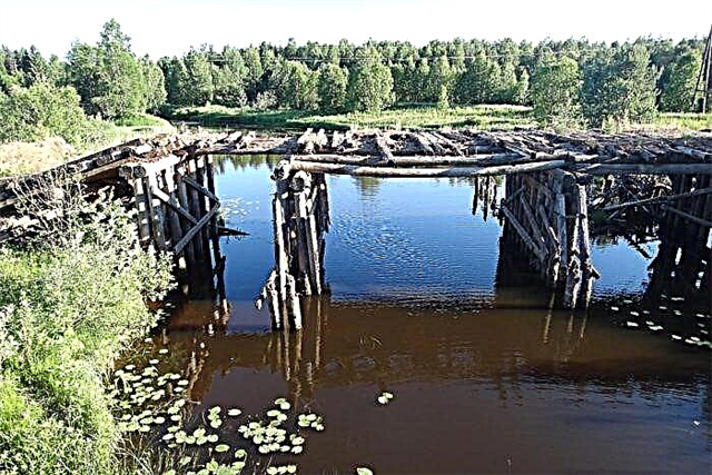
Pilva
The tributary of the Kama, flowing in the Cherdyn region. Its source is the confluence of the North and South Pilvas. A village of the same name is founded on the coast in the middle reaches. The channel winds, the banks are mostly covered with forest. The whole season, when the river is not bound by ice, is actively used for timber rafting. The main attraction of the area is the Pilvensky landscape reserve.
The length of the river is 214 km.
Barda
Right tributary of the Sylva. The floodplain is deep, along the banks there are wooded hills and mountains. The spring current is much faster than the rest of the seasons. At the same time, the river does not overflow. There are picturesque sections of the channel, over which the intertwining cherry bushes hang. The stretches are overgrown with aquatic vegetation. Rafting is convenient both in spring and autumn. Some routes are only suitable for rubber boats.
The length of the river is 209 km.
Birch
The left tributary of the Kolva, belonging to the Cherdynsky district. Berezovaya begins - the confluence of 3 rivers at once. In the upper course, it is 2-3 times narrower than in the lower one. There are 3 villages on the coast.Those parts of the coast that are not covered with spruce-cedar taiga are colorful limestone outcrops on the rocks. The highest rock is Yeran, divided into 6 towers. Its height is 110 meters, and its length is 400 meters.
The length of the river is 208 km.
Velva
It flows in three areas of the region at once It is a left tributary of the Yinva. The adapted translation of the title is “originating from a hill”. The winding riverbed caused the river to change direction several times. The lower reaches are characterized by oxbow lakes, and the upper reaches are limestone outcrops along the banks. Compared to other rivers in the region, there are relatively many settlements here.
The length of the river is 199 km.
Koiva
It originates in the Blue Swamp tract. The banks are inhabited, areas free from settlements are covered with forests. The current is fast, there are rapids and rapids. A rafting route has been laid from Teplaya Gora to the Chusovskaya station. It is especially crowded here in May and June. There are islands in the middle of the river from the days when diamonds were mined in the riverbed. It is believed that in 1829 the first Ural diamond was found in the Koiva basin.
The length of the river is 180 km.
South Keltma
One of the left tributaries of the Kama. The mouth is divided into several unequal arms. In the upper reaches it is narrower and more winding than in the lower reaches. In the past, it was used for rafting trees. There was a short-lived canal connecting the river with North Keltma. The bottom is sandy, there are shallows, the water is clean. The coastal hills are covered with forests of varying density. Pike, roach and ide peck well.
The length of the river is 172 km.
Vilva
It originates in the west of the Ural Range. Left tributary of the Usva. Downstream are the plains, higher up the mountainous terrain. It has several large tributaries, including the Vizhay. The bottom is sandy and rocky. The cliffs along the banks are overgrown with forest. Fishing is year-round, it is better to catch other types of pike from a boat. Hiking is popular, as there are convenient places for setting up tents, a lot of berries and mushrooms.
The length of the river is 170 km.
Grandma
It flows through the territory of two districts of the region: Kungur and Perm. It flows into Sylva near the city of Kungur. Copper and alabaster are mined in the river basin. The forest is partially cut down along the coast. The vacant space was overgrown with vast raspberries and other types of berries. Biting in different areas of Babka differs both in intensity and species diversity of ichthyofauna.
The length of the river is 162 km.
Yazva
Left tributary of the Vishera. It is formed by interweaving the Midday and Northern Yazva into one river. In the spring, the current picks up speed, becomes deeper. Summer is a period of drying up, and some zones become shallow, forming islands among streams. It is interesting to go hiking along the riverbed. You can explore the coastal caves, breathe fresh air in the numerous forests, or pick berries in the summer.
The length of the river is 162 km.
Silver
Occurs at Mount Podpora on the border with the Sverdlovsk Region. The channel makes turns and bends, repeatedly crossing the border between Asia and Europe. Suitable for rafting in the spring months. Only experienced lovers of water adventures will be able to cope with the fast current, numerous fallen trees, rapids and rifts. There is a good bite here in summer.
The length of the river is 147 km.
Urolka
One of the tributaries of the Kama. The basin contains dense forests and woodlands. Small settlements are located along the river bed. The lower reaches are characterized by oxbows and backwaters. The channel is meandering along its entire length. Several large rivers flow into the Urolka, including the Kosva. Fishing is not as intense as in most water bodies of the region. At the same time, you can catch pike and perch all year round.
The length of the river is 140 km.
See
It originates in the east of the region and flows into the Vilva. Refers to mountain rivers, the current is fast. In May, fans of rafting on catamarans and kayaks come to Vizhay. The second category of difficulty has been assigned, so there is nothing for beginner tourists to do here alone. If you arrive too early, there is a risk of getting into an ice jam during the rafting.
The length of the river is 125 km.
Tulwa
The source is in the south of the region. There are also other names, like - Tol or Tolbuy. A flat river with early floods starting in April. Sometimes it lasts up to 30 days. The width of the river is changeable, in the middle course there are well-visible oxbows. Included in the Kama basin. It flows into the Votkinsk reservoir. Of the settlements on the coast, only small villages.
The length of the river is 118 km.
Lysva
Left tributary of the Chusovaya. There are several tributaries, especially large ones: Bursyak and Berezovka. The city of the same name stands on the river. Railroad tracks are laid along the left bank. A dam with a reservoir was built. They were needed for the full operation of the local metallurgical plant. Fishing is year-round, the species diversity of the fish fauna is typical for the region.
The length of the river is 112 km.
Midday Condas
The source is located in the Kudymkar region. The river has many smooth bends of the channel, as well as backwaters and oxbows. The speed of the current is low, there are wetlands. There are significantly more tributaries on the right side than on the left. Accessibility and shallow water affected the biting negatively. More often, fishermen prefer other bodies of water.
The length of the river is 102 km.
Kutamysh
The source is located 20 km from the city of Lysva. Most of the channel is located in the forest belt. Belaya and a number of smaller rivers flow into Kutamysh. There are several villages on the shore. At the confluence with the Kama reservoir, a bay is formed. Different types of fish are found in different parts of the current. For example, in the middle stream, burbot is caught and pike perch is well caught.
The length of the river is 83 km.
Kuva
It flows in the west of the region. It is a tributary of the Yinva. The source belongs to the Chus river basin. The channel winds along its entire length. The dam formed in front of the mouth was named Kuvinsky Pond. The coast is quite densely populated, all villages are small. Fish can be found in Kuva, but there are almost no visitors on the shore: there are more successful fishing spots nearby.
The length of the river is 81 km.
Gaiva
It flows through two districts of the region: Dobryansky and Krasnokamsky, as well as through Perm. The name translates as "cold water" or "bird water". Despite the existence within the city and the presence of businesses nearby, the river is quite clean. It has 32 two tributaries, all shorter than 10 km. Fishermen mostly gather at the estuary. Here, among others, large bream bites.
The length of the river is 76 km.
Chanwa
It flows in the Aleksandrovsky district of the region. The name can be translated as "high-spirited". There are impressive elevation differences along the entire current. The banks are hilly, covered with forest belts. The best time for rafting is after the ice drift. Among the natural beauties of the area, the caves in the coastal outlier cliffs stand out. For example, Chanvin, Labyrinth or Underground Hunters Cave.
The length of the river is 70 km.
Akchim
Refers to the northeast of the region. It originates on the ridge of the Golden Stone. Rapid mountain current for a third of the channel length. There are also rapids of varying difficulty in terms of cross-country ability. The closer the mouth, the less natural barriers and the calmer the water. It flows into Vishera. On an ongoing basis, sports events are held in rafting, as well as in all-around.
The length of the river is 60 km.
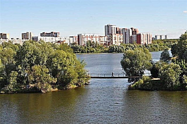
Mulyanka
It flows in Perm. It originates near the village of Zvezdny. Unlike the other city river Gaiva, it has environmental problems due to factories and air pollution from exhaust. Used for household needs. Seven bridges have been built across Mulyanka. There is no shipping, fishing is scarce. But locals rest on the shore in warm weather.
The length of the river is 52 km.